Sale on canvas prints! Use code ABCXYZ at checkout for a special discount!

Previous Image

|

Next Image
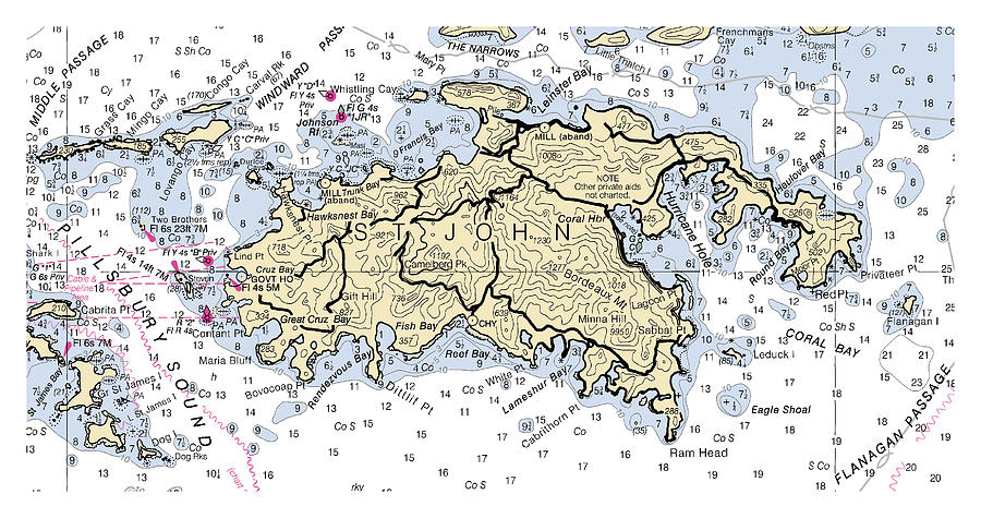
St John, Noaa Chart 25641-4 Digital Art by Nautical Chartworks

Similar Images

Amelia Island to St. Augustine, NOAA Chart 11488 by Nautical Chartworks
St Simons Sound to Tolomato River, NOAA Chart 11489 by Nautical Chartworks
Approaches to St. Johns River Florida, NOAA Chart 11490 by Nautical Chartworks
St. Johns River Dunns Creek to Lake Dexter Florida, NOAA Chart 11495_1 by Nautical Chartworks
St. Marys Entrance Cumberland Sound and Kings Bay Florida, Georgia, NOAA Chart 11503 by Nautical Chartworks
Pillsbury Sound St Thomas-st John, Noaa Chart 25647 by Nautical Chartworks
St Johns River Racy Point to Crescent Lake, NOAA Chart 11487 by Nautical Chartworks
St Johns River Racy Point to Crescent Lake, NOAA Chart 11487_1 by Nautical Chartworks
St Johns River Racy Point to Crescent Lake, NOAA Chart 11487_2 by Nautical Chartworks
St Simons Sound to Tolomato River, NOAA Chart 11489_1 by Nautical Chartworks
St Simons Sound to Tolomato River, NOAA Chart 11489_2 by Nautical Chartworks
St Simons Sound to Tolomato River, NOAA Chart 11489_3 by Nautical Chartworks
St Simons Sound to Tolomato River, NOAA Chart 11489_4 by Nautical Chartworks
Approaches to St. Johns River Florida, NOAA Chart 11490_1 by Nautical Chartworks
Approaches to St. Johns River Florida, NOAA Chart 11490_2 by Nautical Chartworks
St. Johns River, Atlantic Ocean to Jacksonville Florida, NOAA Chart 11491 by Nautical Chartworks
St. Johns River Jacksonville to Racy Point Florida, NOAA Chart 11492 by Nautical Chartworks
St. Johns River Dunns Creek to Lake Dexter Florida, NOAA Chart 11495 by Nautical Chartworks
St. Johns River Dunns Creek to Lake Dexter Florida, NOAA Chart 11495_2 by Nautical Chartworks

Recently Viewed

St John, Noaa Chart 25641-4 by Nautical Chartworks
Previous Image Next Image